Wednesday, August 31, 2016

Campsite at Mile 1737.45 to Paved Dead Indian Memorial Road

Hiked and hiked some more. 

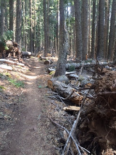
We are hiking through forests with occasional views of mountains. 

Got up this morning and the temperature was in the 40s and the day stayed reasonably cool, a welcome change in the weather. 

We passed the 900 miles to go point today. Someone made a nice 900 sign out of pine cones. 

We met two women, Pop Tart and Flower, who are aiming for the self supported fastest time for the PCT. they are trying to finish the trail in 60 days or less, hiking 50 miles or more per day. They seemed very upbeat at this point, I hope they can keep up the pace.


Video: Waterfall steaming because the air was cold?


Flower - She had to skip the fire closure, and thus her FKT attempt ended, but she kept going to Mexico, making it in 67 days total.

Pop Tart's blog: https://poptartpct.wordpress.com/

Their FKT (Fastest Known Time) attempt of the PCT didn't work out, since the trail was closed in the Seiad Valley area that we just hiked through. But there were a couple good articles about their attempt, which began as separate efforts. https://thetrek.co/pacific-crest-trail/the-why-2/


----------------------

2021 Update:


Hiked and hiked some more. 

We are hiking through forests with occasional views of mountains. 

Got up this morning and the temperature was in the 40s and the day stayed reasonably cool, a welcome change in the weather. 

We passed the 900 miles to go point today. Someone made a nice 900 sign out of pine cones. 

We met two women, Pop Tart and Flower, who are aiming for the self supported fastest time for the PCT. they are trying to finish the trail in 60 days or less, hiking 50 miles or more per day. They seemed very upbeat at this point, I hope they can keep up the pace.


Photos from today: Hmm, oddly, none on my photo site, so check out my blog entry I guess. http://blog.b-photo.com/2016/08/wednesday-august-30.html

Mighty Mouse's blog for today: http://www.timandgerri.com/blog---2016/day-134-31-august-mile-173745-175908

Tuesday, August 30, 2016

Paved Old Highway 99 to Campsite at Mile 1737.45

Hiking in fire smoke. 

Left the comforts of Callahan's Lodge today and am back to hiking. 

As soon as I climbed up in elevation a bit, the air became quite smoky and visibility to the surrounding hills became pretty poor. 

Fortunately the breeze picked up later in the day and cleared out the smoke a little.


------------------
2021 Update:

Hiking in fire smoke. 

Left the comforts of Callahan's Lodge today and we are back to hiking. 

As soon as we climbed up in elevation a bit, the air became quite smoky and visibility to the surrounding hills became pretty poor. There are some pretty big fires in the area. Well, not really in the area, miles away, but the wind it bringing the smoke to us.

Fortunately the breeze picked up later in the day and cleared out the smoke a little.


Photos from today: https://www.b-photo.com/Travel/PCT-2016-Day-by-Day/August/August-30/

Mighty Mouse's blog for today: http://www.timandgerri.com/blog---2016/day-133-30-august-mile-171619-173745

Sunday, August 28, 2016

Campsite in the wooded saddle to Paved Old Highway 99

Callahan's Lodge/Ashland 

Sixteen miles to a town stop 
With beds and a shower and restaurants? Done. 

Had some up and down, but overall a pretty easy day. Less miles make my feet, ankles and knees happier. 

Mighty Mouse, Share Bear and I got to a road crossing near Interstate 5 and were met by Tim who drove us to Ashland for Mighty Mouse to see a doctor about things growing on her feet. Prescriptions obtained, we went grocery shopping and then to dinner at Caldera Brewery in Ashland. 
We stayed the night at Callahan's Lodge, which offers a great hiker rate on rooms. 

On the trail today we came across a cooler with sodas and a couple lawn chairs. Thanks to the trail angels who maintain little bits of trail magic like that.


---------------
2021 Update:

Callahan's Lodge/Ashland 

Sixteen miles to a town stop 
With beds and a shower and restaurants? Done. 

Had some up and down, but overall a pretty easy day. Less miles make my feet, ankles and knees happier. 

Mighty Mouse, Share Bear and I got to a road crossing near Interstate 5 and were met by Tim who drove us to Ashland for Mighty Mouse to see a doctor about things growing on her feet. Prescriptions obtained, we went grocery shopping and then to dinner at Caldera Brewery in Ashland. 
We stayed the night at Callahan's Lodge, which offers a great hiker rate on rooms. 

On the trail today we came across a cooler with sodas and a couple lawn chairs. Thanks to the trail angels who maintain little bits of trail magic like that.


Photos from today: https://www.b-photo.com/Travel/PCT-2016-Day-by-Day/August/August-28/

Mighty Mouse's blog for today: http://www.timandgerri.com/blog---2016/day-131-28-august-mile-170010-171619

Saturday, August 27, 2016

Campsite by unpaved road 47N81 to Campsite in the wooded saddle

Oregon! 

The big event of the day was finally making it to the California/Oregon border! One state down, two to go. 

Out of 2650 of trail, 1689 are in California. That's a lot of miles and a lot of variety. 

And now comes Oregon, which has a reputation for being relatively easy, and where I need to put in some longer mile days to try to get to the mountains in Washington before snow sets in. 

For now, I am camped near mile 1700 of the trail, listening to the wind in the treetops.


---------------
2021 Update:

The big event of the day was finally making it to the California/Oregon border! One state down, two to go. 

Out of 2650 of trail, 1689 are in California. That's a lot of miles and a lot of variety. 

And now comes Oregon, which has a reputation for being relatively easy, and where I need to put in some longer mile days to try to get to the mountains in Washington before snow sets in. 

For now, I am camped near mile 1700 of the trail, listening to the wind in the treetops.


Photos from today: https://www.b-photo.com/Travel/PCT-2016-Day-by-Day/August/August-27/

Mighty Mouse's blog for today: http://www.timandgerri.com/blog---2016/day-130-27-august-mile-167767-170010

Friday, August 26, 2016

Campsite at mile 1658.03 to Campsite by unpaved road 47N81

Some days you wish for a road walk. 

Lots of climbing today, and I seem to slow to a crawl on steep up hills, especially when it is hot, and it was hot today. 

At one point the trail crossed a dirt road, and I remember seeing on a map that the trail crossed this road in a few miles. But I stuck to the trail. The trail went up and down on the side of a mountain with views of the road below. The rocks on the trail made my feet wish I had taken the road, with its presumably smoother surface. 

Oh well, with the help of ibuprofen my feet have completed another day. Tomorrow we get to the California/Oregon border!


------------------
2021 Update:

Some days you wish for a road walk. 

Lots of climbing today, and I seem to slow to a crawl on steep up hills, especially when it is hot, and it was hot today. 

At one point the trail crossed a dirt road, and I remember seeing on a map that the trail crossed this road in a few miles. But I stuck to the trail. The trail went up and down on the side of a mountain with views of the road below. The rocks on the trail made my feet wish I had taken the road, with its presumably smoother surface. 

Oh well, with the help of ibuprofen my feet have completed another day. Tomorrow we get to the California/Oregon border!


Photos from today: https://www.b-photo.com/Travel/PCT-2016-Day-by-Day/August/August-26/

Mighty Mouse's blog for today: http://www.timandgerri.com/blog---2016/day-129-26-august-mile-165803-167767

Thursday, August 25, 2016

Campsite on Cold Spring Creek to Campsite at mile 1658.03

Down to Seiad Valley, up from Seiad Valley. 

Woke up at our creek side campsite and met Granny Gear and Cloud. They had gotten to the site ahead of us and were wiped out and slept right through our arrival and setup of camp. 

Set out for town and Share Bear was anticipating lunch and took off at a pace that Mighty Mouse and I could not match. 

We descended along a couple creek valleys and ended up at the Klamath River. The Seiad Cafe and Store were right there, across the river. Unfortunately nobody has built a footbridge where PCT hikers would like one, so we had about five miles of road walking to get to town, down to a bridge and then back to the cafe. We did make it before they closed at 2pm and I had a delicious burger and milkshake. 

The good part of the road walking was the presence of abundant blackberry bushes. 

Much of the hike today was through burn areas. I think the fire was last year, and there were a couple bridges that were burned, so we got to do some rock hopping and log crossing that we haven't done much of in a while. 

Tim met us with our food resupply for the next few days and we relaxed and chatted with other hikers until about 5pm when we headed back out to start the climb out of Seiad Valley. 

We are camped about 2400 feet higher than the valley floor tonight, being serenaded by a chorus of crickets.


-------------------
2021 Update:

Down to Seiad Valley, up from Seiad Valley. 

Woke up at our creek side campsite and met Granny Gear and Cloud. They had gotten to the site ahead of us and were wiped out and slept right through our arrival and setup of camp. 

Set out for town and Share Bear was anticipating lunch and took off at a pace that Mighty Mouse and I could not match. 

We descended along a couple creek valleys and ended up at the Klamath River. The Seiad Cafe and Store were right there, across the river. Unfortunately nobody has built a footbridge where PCT hikers would like one, so we had about five miles of road walking to get to town, down to a bridge and then back to the cafe. We did make it before they closed at 2pm and I had a delicious burger and milkshake. 

The good part of the road walking was the presence of abundant blackberry bushes. 

Much of the hike today was through burn areas. I think the fire was last year, and there were a couple bridges that were burned, so we got to do some rock hopping and log crossing that we haven't done much of in a while. 

Tim met us with our food resupply for the next few days and we relaxed and chatted with other hikers until about 5pm when we headed back out to start the climb out of Seiad Valley. 

The climb out of Seiad Valley is a bit daunting, and a couple locals were offering to drive people up to the top on their ATVs. I'm not sure if anyone took them up on the offer.

We are camped about 2400 feet higher than the valley floor tonight, being serenaded by a chorus of crickets.


Photos from today: https://www.b-photo.com/Travel/PCT-2016-Day-by-Day/August/August-25/

Mighty Mouse's blog for today: http://www.timandgerri.com/blog---2016/day-128-25-august-mile-163910-165803